
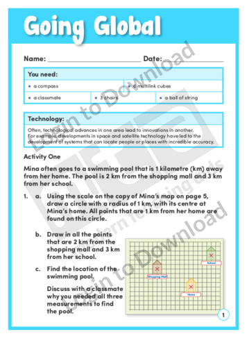
Going Global’ provides activities to support students’ understanding of how GPS works. They can also use latitude and longitude co-ordinates to help locate a mystery object. This activity includes comprehensive teaching notes to be read before beginning the activity with students, as they feature useful background information and suggestions for supporting learning. An answer sheet …More

This reading comprehension activity ‘A Healthy Rise in Vaccinations’, asks students to answer comprehension questions on a text about vaccination rates in America.
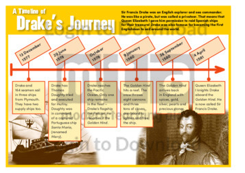
This history timeline, ‘Drake’s Journey’ features important dates and factual background information about the famous English explorer Sir Francis Drake and his journey around the world. This is a great resource for broadening students’ historical and cultural knowledge about the United Kingdom and could be used as a prompt for further discussion or study of …More
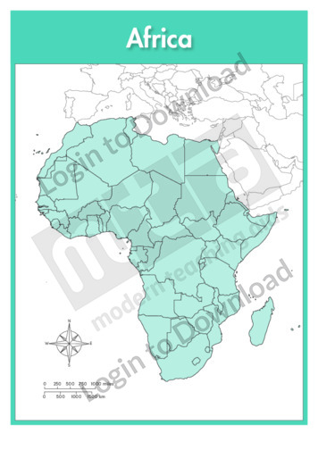
This full colour map of Africa political is a single full page map complete with compass and scale that can be reproduced for classroom use. It is left blank for students to identify and label the countries, cities, geographical landmarks and surrounding oceans.
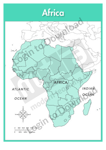
This full colour map of Africa political with labels is a single full page map complete with compass and scale that can be reproduced for classroom use. It features country borders and surrounding oceans.

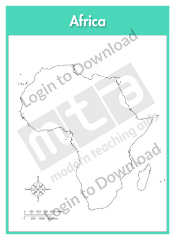
This full colour continent map of Africa is a single full page map complete with compass and scale that can be reproduced for classroom use. It is left blank for students to identify and label countries, key cities, bordering countries and surrounding seas and oceans.
This continent outline map of Africa with labels is a single full page map complete with compass and scale that can be reproduced for classroom use. It features labelled surrounding seas and oceans.
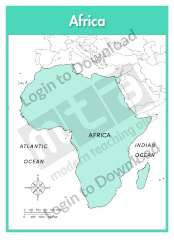
This full colour continent map of Africa with labels is a single full page map complete with compass and scale that can be reproduced for classroom use. It features labelled surrounding seas and oceans.
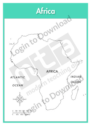
This continent outline map of Africa is a single full page map complete with compass and scale that can be reproduced for classroom use. It is left blank for students to identify and label countries, key cities, bordering countries and surrounding seas and oceans.
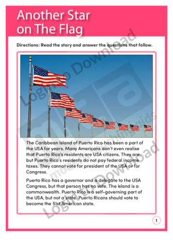
This reading comprehension activity, ‘Another Star on the Flag’, asks students to answer comprehension questions on a text about Puerto Rico and the United States.
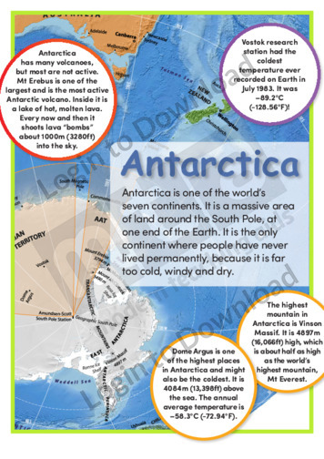
This article, ‘Antarctica’, provides information about Antarctica. It is aimed at broadening students’ geographical awareness and includes colourful and engaging images.
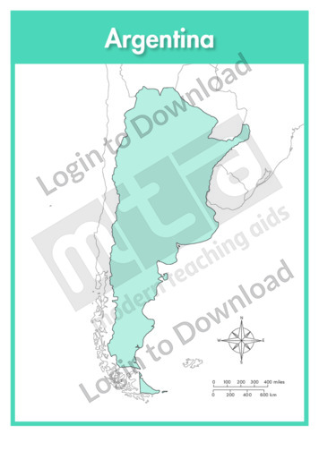
This full colour map of Argentina is a single full page map complete with compass and scale that can be reproduced for classroom use. It is left blank for students to identify and label key cities, geographical landmarks, geographical landmarks, surrounding oceans and bordering countries.
This outline map of Argentina with labels is a single full page map complete with compass and scale that can be reproduced for classroom use. It features labelled key cities, geographical landmarks and surrounding oceans.
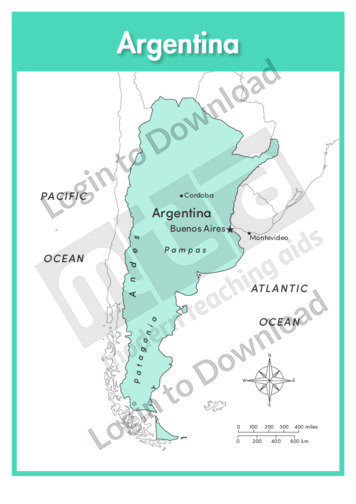
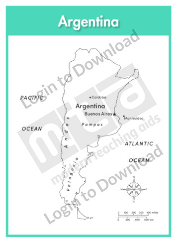
This full colour map of Argentina with labels is a single full page map complete with compass and scale that can be reproduced for classroom use. It features labelled key cities, geographical landmarks, surrounding oceans and indicates bordering countries.
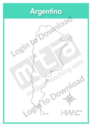
This outline map of Argentina is a single full page map complete with compass and scale that can be reproduced for classroom use. It is left blank for students to identify and label key cities, geographical landmarks and surrounding oceans.
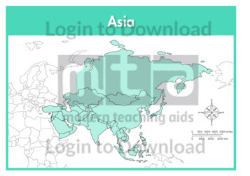
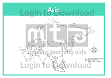
This continent map of Asia is a single full page map complete with compass and scale that can be reproduced for classroom use. It is left blank for students to identify and label countries, key cities, bordering countries and surrounding seas and oceans.
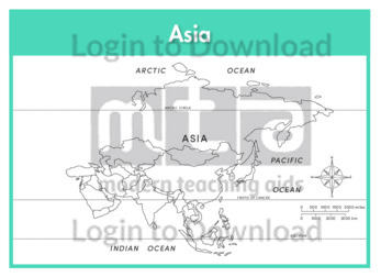
This continent outline map of Asia with labels is a single full page map complete with compass and scale that can be reproduced for classroom use. It features labelled surrounding seas and oceans.
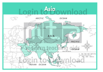
This continent map of Asia with labels is a single full page map complete with compass and scale that can be reproduced for classroom use. It features labelled surrounding seas and oceans.
This continent outline map of Asia is a single full page map complete with compass and scale that can be reproduced for classroom use. It is left blank for students to identify and label countries, key cities, bordering countries and surrounding seas and oceans.
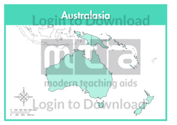
This continent full colour map of Australasia is a single full page map complete with compass and scale that can be reproduced for classroom use. It is left blank for students to identify and label countries, key cities, bordering countries and surrounding seas and oceans.
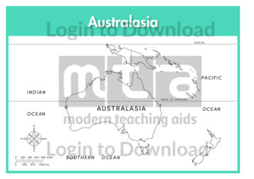
This continent outline map of Australasia with labels is a single full page map complete with compass and scale that can be reproduced for classroom use. It features labelled surrounding seas and oceans.
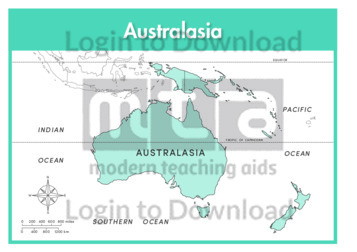
This continent full colour map of Australasia with labels is a single full page map complete with compass and scale that can be reproduced for classroom use. It features labelled surrounding seas and oceans.
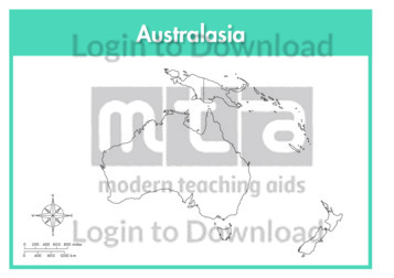
This continent outline map of Australasia is a single full page map complete with compass and scale that can be reproduced for classroom use. It is left blank for students to identify and label countries, key cities, bordering countries and surrounding seas and oceans.
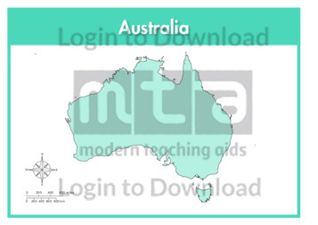
This full colour map of Australia is a single full page map complete with compass and scale that can be reproduced for classroom use. It is left blank for students to identify and label states, key cities, geographical landmarks, surrounding oceans.
This outline map of Australia with labels is a single full page map complete with compass and scale that can be reproduced for classroom use. It features labelled key cities and surrounding oceans.
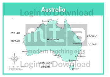
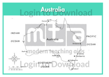
This full colour map of Australia with labels is a single full page map complete with compass and scale that can be reproduced for classroom use. It features labelled key cities and surrounding oceans.
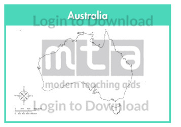
This outline map of Australia is a single full page map complete with compass and scale that can be reproduced for classroom use. It is left blank for students to identify and label states, key cities, geographical landmarks and surrounding oceans.
This outline map of Australia with state labels is a single full page map complete with compass and scale that can be reproduced for classroom use. It features labelled states, key cities and surrounding oceans.
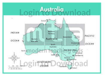
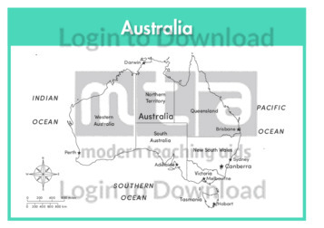
This full colour map of Australia with state labels is a single full page map complete with compass and scale that can be reproduced for classroom use. It features labelled states, key cities and surrounding oceans.
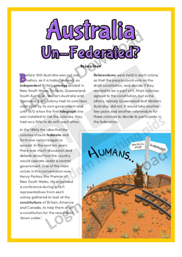
This history article, ‘Australia Un-Federated’ imagines what it would be like if the British colonies of Australia had never joined together to form one nation. It provides factual information about how Australia was formed and is aimed at broadening students’ cultural and historical awareness in a fun and engaging manner.
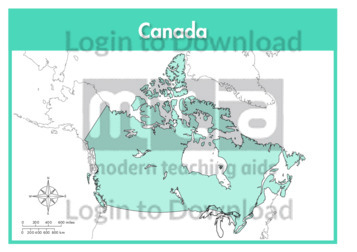
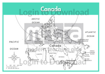
This full colour map of Canada is a single full page map complete with compass and scale that can be reproduced for classroom use. It is left blank for students to identify and label provinces, key cities, geographical landmarks, surrounding oceans and bordering countries.
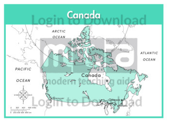
This outline map of Canada with labels is a single full page map complete with compass and scale that can be reproduced for classroom use. It features labelled key cities and surrounding oceans.
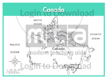
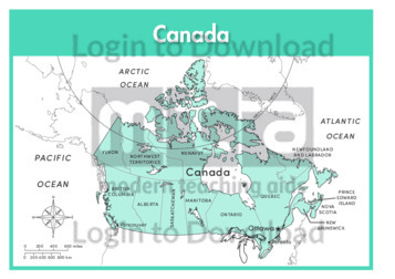
This full colour map of Canada with labels is a single full page map complete with compass and scale that can be reproduced for classroom use. It features labelled key cities, surrounding oceans and indicates bordering countries.
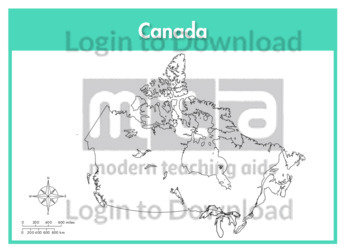
This outline map of Canada is a single full page map complete with compass and scale that can be reproduced for classroom use. It is left blank for students to identify and label provinces, key cities, geographical landmarks and surrounding oceans.
This outline map of Canada with provinces is a single full page map complete with compass and scale that can be reproduced for classroom use. It features labelled provinces, key cities and surrounding oceans.
This full colour map of Canada with provinces is a single full page map complete with compass and scale that can be reproduced for classroom use. It features labelled provinces, key cities, surrounding oceans and indicates bordering countries.
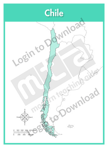
This full colour map of Chile is a single full page map complete with compass and scale that can be reproduced for classroom use. It is left blank for students to identify and label key cities, geographical landmarks, surrounding oceans and bordering countries.
This outline map of Chile with labels is a single full page map complete with compass and scale that can be reproduced for classroom use. It features the labelled capital city and surrounding oceans.
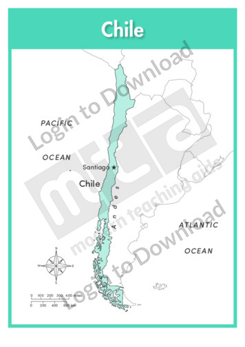
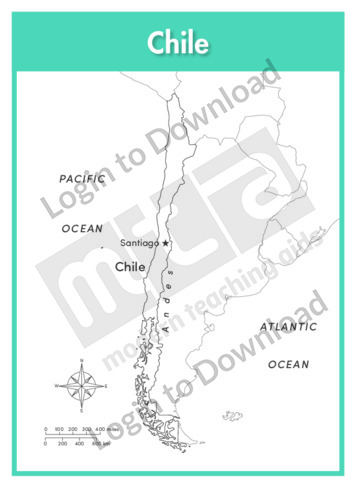
This full colour map of Chile with labels is a single full page map complete with compass and scale that can be reproduced for classroom use. It features the labelled capital city, geographical landmarks, surrounding oceans and indicates bordering countries.
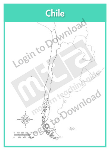
This outline map of Chile is a single full page map complete with compass and scale that can be reproduced for classroom use. It is left blank for students to identify and label key cities, geographical landmarks and surrounding oceans.
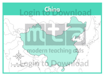
This full colour map of China is a single full page map complete with compass and scale that can be reproduced for classroom use. It is left blank for students to identify and label key cities, geographical landmarks, surrounding seas and bordering countries.
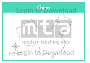
This outline map of China with labels is a single full page map complete with compass and scale that can be reproduced for classroom use. It features labelled key cities and surrounding seas.
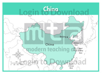
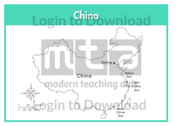
This full colour map of China with labels is a single full page map complete with compass and scale that can be reproduced for classroom use. It features the labelled capital city, surrounding seas and indicates bordering countries.
This outline map of China with provinces is a single full page map complete with compass and scale that can be reproduced for classroom use. It features province borders for students to identify and label along with key cities, geographical landmarks and surrounding seas.
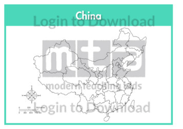
This outline map of China is a single full page map complete with compass and scale that can be reproduced for classroom use. It is left blank for students to identify and label key cities, geographical landmarks and surrounding seas.
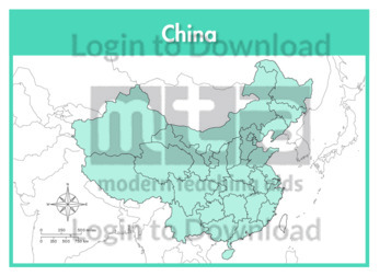
This full colour map of China with provinces is a single full page map complete with compass and scale that can be reproduced for classroom use. It features province borders for students to identify and label along with key cities, geographical landmarks and surrounding seas.
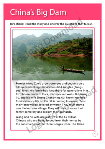
This reading comprehension activity ‘China’s Big Dam’, asks students to answer comprehension questions on a text about China’s new dam.
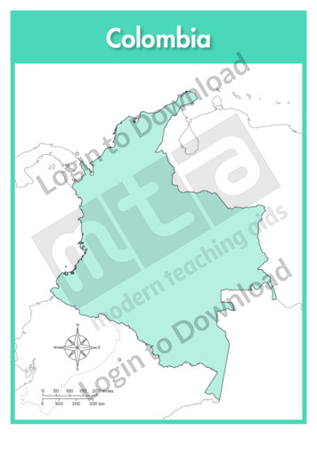
This full colour map of Columbia is a single full page map complete with compass and scale that can be reproduced for classroom use. It is left blank for students to identify and label key cities, geographical landmarks, surrounding seas and oceans and bordering countries.
This outline map of Columbia with labels is a single full page map complete with compass and scale that can be reproduced for classroom use. It features the labelled capital city and surrounding seas and oceans.
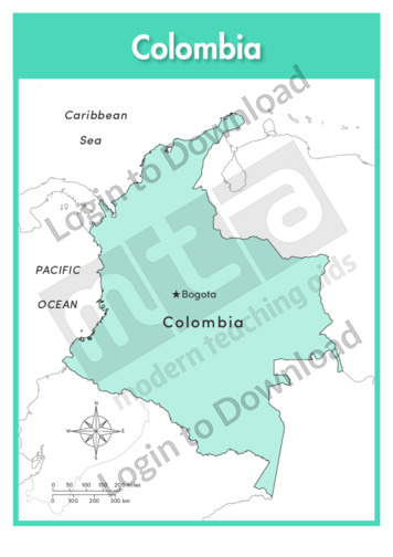
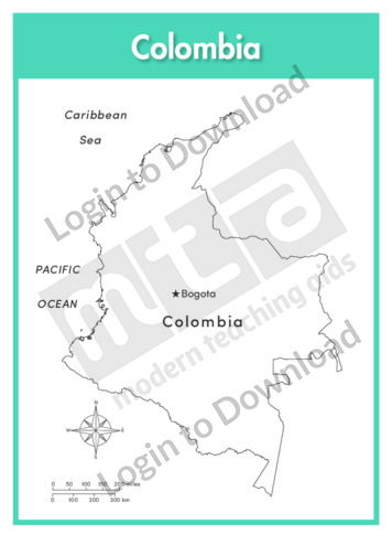
This full colour map of Columbia with labels is a single full page map complete with compass and scale that can be reproduced for classroom use. It features the labelled capital city, surrounding seas and oceans and indicates bordering countries.
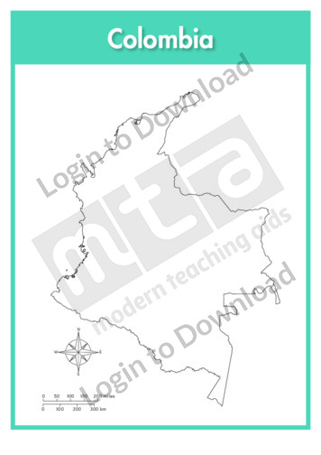
This outline map of Columbia is a single full page map complete with compass and scale that can be reproduced for classroom use. It is left blank for students to identify and label key cities and surrounding seas and oceans.
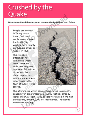
This reading comprehension activity, ‘Crushed by the Quake’, asks students to answer comprehension questions on a text about earthquakes in Turkey.
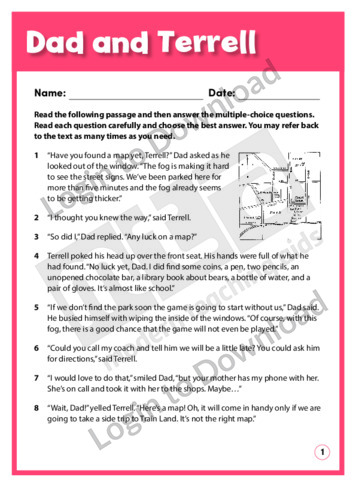
The story ‘Dad and Terrell’ is about a father and son who are in the car on their way to a game. Terrell has to find the map and help Dad find the way. The story provides opportunities for students to practise vocabulary and comprehension skills. Answer sheet provided with file download.
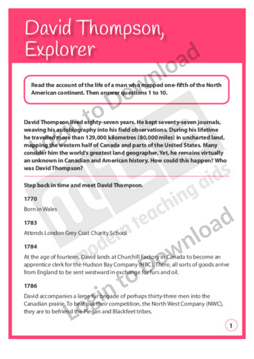
This Reading Comprehension worksheet, ‘David Thompson, Explorer’, features a biographical text about one of the world’s greatest land geographers. It encourages students to use a variety of strategies to interpret the text and includes questions about character, detail, reasoning, validity, cause and effect, fact/opinion, sequence, theme, making a judgment, and reasoning. Answer sheet provided with …More
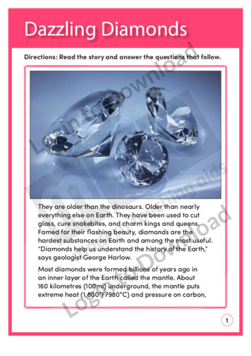
This reading comprehension activity ‘Dazzling Diamonds’, asks students to answer comprehension questions on a text about the history and mining of diamonds.
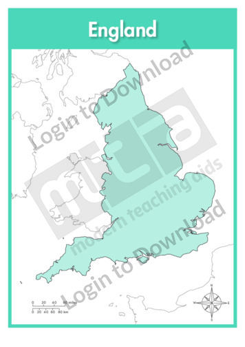
This full colour map of England is a single full page map complete with compass and scale that can be reproduced for classroom use. It is left blank for students to identify and label key cities, geographical landmarks, surrounding seas and bordering countries.
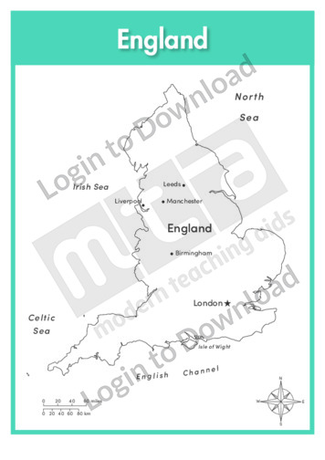
This outline map of England with labels is a single full page map complete with compass and scale that can be reproduced for classroom use. It features labelled key cities and surrounding seas.
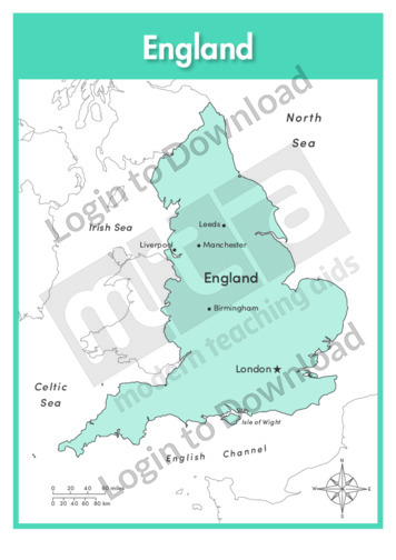
This full colour map of England with labels is a single full page map complete with compass and scale that can be reproduced for classroom use. It features labelled key cities, surrounding seas and indicates bordering countries.
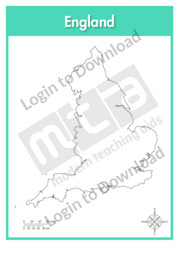
This outline map of England is a single full page map complete with compass and scale that can be reproduced for classroom use. It is left blank for students to identify and label key cities, geographical landmarks and surrounding seas.
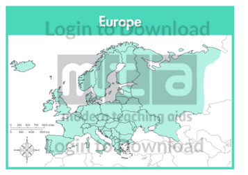
This continent map of Europe is a single full page map complete with compass and scale that can be reproduced for classroom use. It is left blank for students to identify and label countries, key cities, bordering countries and surrounding seas and oceans.
It�s that easy!