
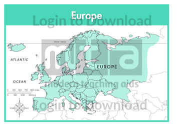
This continent outline map of Europe with labels is a single full page map complete with compass and scale that can be reproduced for classroom use. It features labelled surrounding seas and oceans.
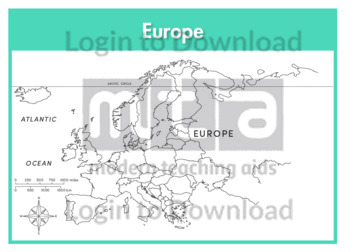
This continent map of Europe with labels is a single full page map complete with compass and scale that can be reproduced for classroom use. It features labelled surrounding seas and oceans.
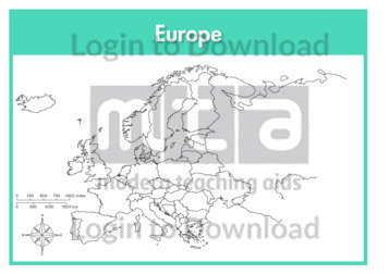
This continent outline map of Europe is a single full page map complete with compass and scale that can be reproduced for classroom use. It is left blank for students to identify and label countries, key cities, bordering countries and surrounding seas and oceans.
This full colour map of France is a single full page map complete with compass and scale that can be reproduced for classroom use. It is left blank for students to identify and label key cities, geographical landmarks, surrounding seas and bordering countries. It also includes an inset of the French territory Corsica and a …More
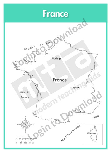
This outline map of France with labels is a single full page map complete with compass and scale that can be reproduced for classroom use. It features labelled key cities and surrounding seas. It also includes an inset of the French territory Corsica and a compass and scale.
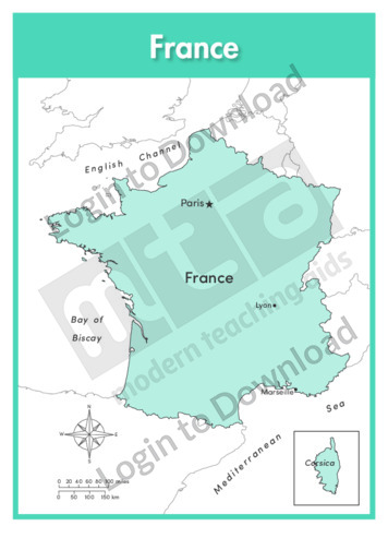
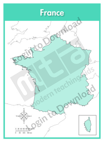
This full colour map of France with labels is a single full page map complete with compass and scale that can be reproduced for classroom use. It features labelled key cities, surrounding seas and indicates bordering countries. It also includes an inset of the French territory Corsica and a compass and scale.
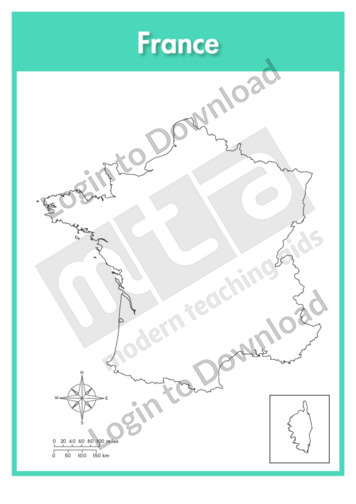
This outline map of France is a single full page map complete with compass and scale that can be reproduced for classroom use. It is left blank for students to identify and label key cities, geographical landmarks and surrounding seas. It also includes an inset of the French territory Corsica and a compass and scale.
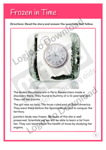
This reading comprehension activity, ‘Frozen in Time’, asks students to answer comprehension questions on the Andes Mountains in Peru.
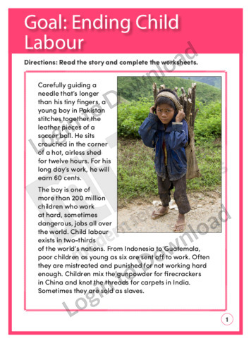
This reading comprehension activity ‘Goal: Ending Child Labour’, asks students to answer comprehension questions on a text about ending child labour.
This full colour map of Hong Kong is a single full page map complete with compass and scale that can be reproduced for classroom use. It is left blank for students to identify and label key cities, geographical landmarks, surrounding seas and bordering countries.
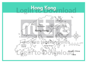
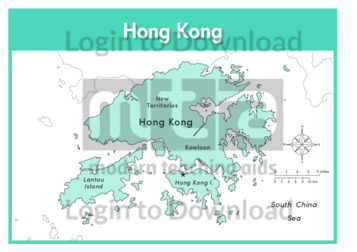
This outline map of Hong Kong with labels is a single full page map complete with compass and scale that can be reproduced for classroom use. It features labelled key cities and surrounding seas.
This full colour map of Hong Kong with labels is a single full page map complete with compass and scale that can be reproduced for classroom use. It features labelled key cities, surrounding seas and indicates bordering countries.
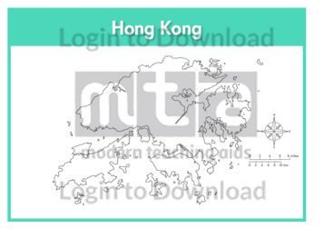
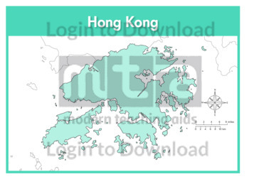
This outline map of Hong Kong is a single full page map complete with compass and scale that can be reproduced for classroom use. It is left blank for students to identify and label key cities and surrounding seas.
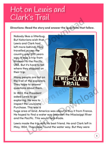
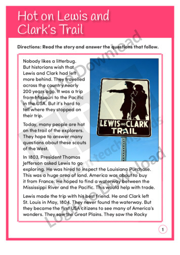
This reading comprehension activity, ‘Hot on Lewis and Clark’s Trail’, is available at two different reading levels to allow for differentiated instruction. It asks students to answer comprehension questions on a text about two explorers who travelled across America.
This reading comprehension activity, ‘Hot on Lewis and Clark’s Trail’, asks students to answer comprehension questions on a text about two explorers who travelled across America.

This full colour map of India is a single full page map complete with compass and scale that can be reproduced for classroom use. It is left blank for students to identify and label key cities, geographical landmarks, surrounding seas and oceans and bordering countries.
This outline map of India with labels is a single full page map complete with compass and scale that can be reproduced for classroom use. It features labelled key cities and surrounding seas and oceans.
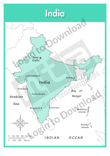
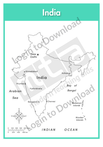
This full colour map of India with labels is a single full page map complete with compass and scale that can be reproduced for classroom use. It features labelled key cities, surrounding seas and oceans and indicates bordering countries.
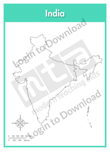
This outline map of India is a single full page map complete with compass and scale that can be reproduced for classroom use. It is left blank for students to identify and label key cities, geographical landmarks and surrounding seas and oceans.
This full colour map of Indonesia is a single full page map complete with compass and scale that can be reproduced for classroom use. It is left blank for students to identify and label islands, key cities, geographical landmarks, surrounding seas and oceans and bordering countries.
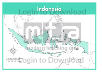
This outline map of Indonesia with labels is a single full page map complete with compass and scale that can be reproduced for classroom use. It features labelled islands and surrounding seas.
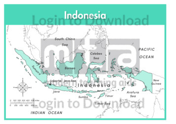
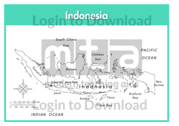
This full colour map of Indonesia with labels is a single full page map complete with compass and scale that can be reproduced for classroom use. It features labelled islands, surrounding seas and oceans and indicates bordering countries.
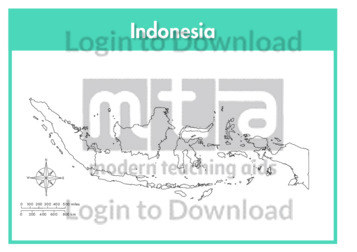
This outline map of Indonesia is a single full page map complete with compass and scale that can be reproduced for classroom use. It is left blank for students to identify and label islands, key cities, geographical landmarks and surrounding seas and oceans.
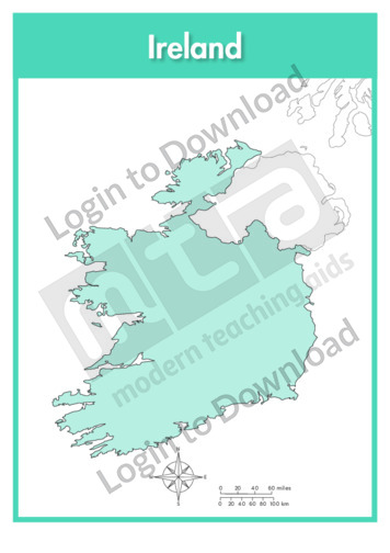
This full colour map of Ireland is a single full page map complete with compass and scale that can be reproduced for classroom use. It is left blank for students to identify and label key cities, geographical landmarks, surrounding seas and oceans and bordering countries.
This outline map of Ireland with labels is a single full page map complete with compass and scale that can be reproduced for classroom use. It features the labelled capital city and surrounding seas and oceans.
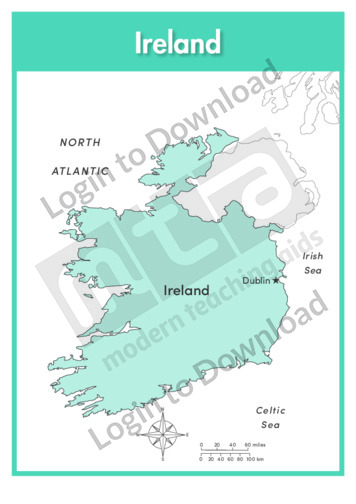
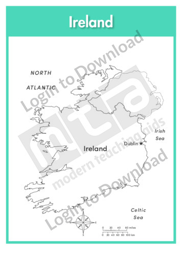
This full colour map of Ireland with labels is a single full page map complete with compass and scale that can be reproduced for classroom use. It features the labelled capital city, surrounding seas and oceans and indicates bordering countries.
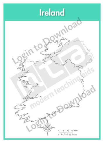
This outline map of Ireland is a single full page map complete with compass and scale that can be reproduced for classroom use. It is left blank for students to identify and label key cities, geographical landmarks and surrounding seas and oceans.
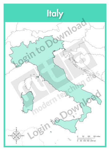
This full colour map of Italy is a single full page map complete with compass and scale that can be reproduced for classroom use. It is left blank for students to identify and label key cities, geographical landmarks, surrounding seas and bordering countries.
This outline map of Italy with labels is a single full page map complete with compass and scale that can be reproduced for classroom use. It features labelled key cities and surrounding seas.
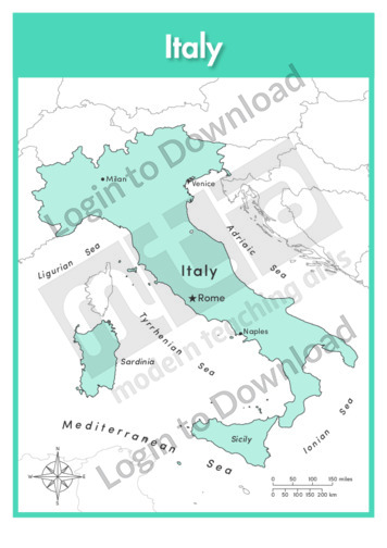
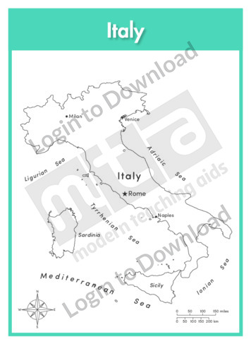
This full colour map of Italy with labels is a single full page map complete with compass and scale that can be reproduced for classroom use. It features labelled key cities, geographical landmarks, surrounding seas and indicates bordering countries.
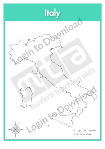
This outline map of Italy is a single full page map complete with compass and scale that can be reproduced for classroom use. It is left blank for students to identify and label key cities and surrounding seas.
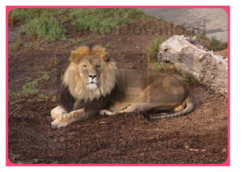
This oral language photo activity ‘Lion’, enhances vocabulary and concept development by providing a thought-provoking visual stimulus that can be used as a prompt to engage students in discussion. Each photo is complete with an accompanying lesson plan featuring tips and activities to develop oral language and vocabulary further.
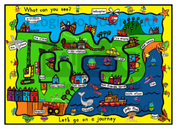
This full colour ‘Let’s Go On a Journey’ map can be reproduced for classroom use. It encourages students to identify some of the most common features of the community and can be a fun educational activity or a bright and colourful addition to a community or holidays themed classroom display.
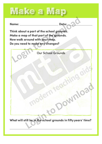
This Earth Science worksheet, ‘Make a Map’ asks students to map part of their school then imagine how it would change over time. It supports an understanding of change and of maps.
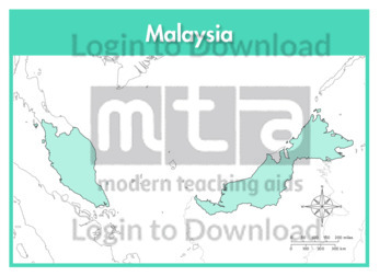
This full colour map of Malaysia is a single full page map complete with compass and scale that can be reproduced for classroom use. It is left blank for students to identify and label key cities, geographical landmarks, surrounding seas and bordering countries.
This outline map of Malaysia with labels is a single full page map complete with compass and scale that can be reproduced for classroom use. It features the labelled capital city and surrounding seas.
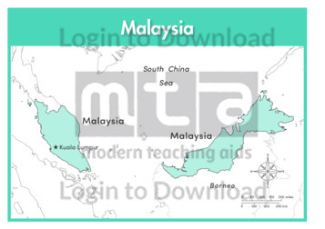
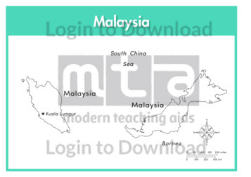
This full colour map of Malaysia with labels is a single full page map complete with compass and scale that can be reproduced for classroom use. It features the labelled capital city, surrounding seas and indicates bordering countries.
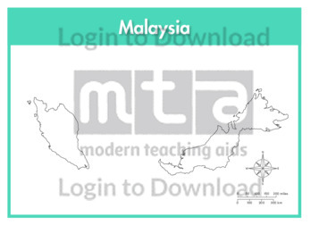
This outline map of Malaysia is a single full page map complete with compass and scale that can be reproduced for classroom use. It is left blank for students to identify and label key cities and surrounding seas.
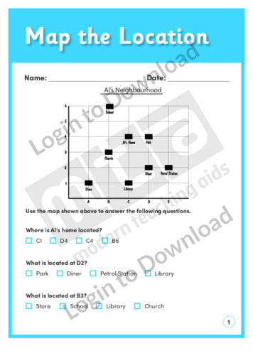
This location and transformation worksheet, ‘Map the Location’ allows for practice using coordinates. Answer sheet provided with file download.
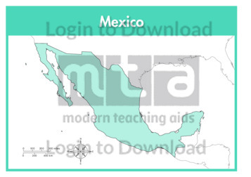
This full colour map of Mexico is a single full page map complete with compass and scale that can be reproduced for classroom use. It is left blank for students to identify and label key cities, geographical landmarks, surrounding seas and oceans and bordering countries.
This outline map of Mexico with labels is a single full page map complete with compass and scale that can be reproduced for classroom use. It features labelled key cities and surrounding seas and oceans.
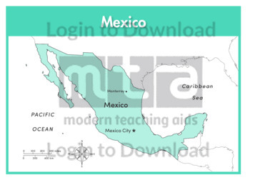
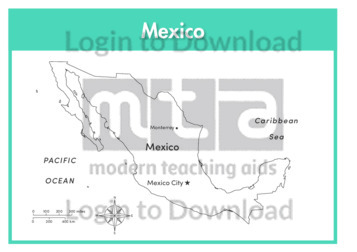
This full colour map of Mexico with labels is a single full page map complete with compass and scale that can be reproduced for classroom use. It features labelled key cities, surrounding seas and oceans and indicates bordering countries.
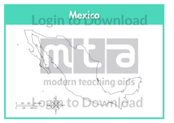
This outline map of Mexico is a single full page map complete with compass and scale that can be reproduced for classroom use. It is left blank for students to identify and label key cities, geographical landmarks and surrounding seas and oceans.
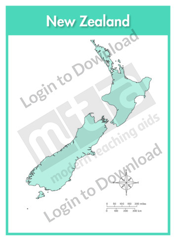
This full colour map of New Zealand is a single full page map complete with compass and scale that can be reproduced for classroom use. It is left blank for students to identify and label key cities, geographical landmarks, surrounding seas and oceans.
This outline map of New Zealand with labels is a single full page map complete with compass and scale that can be reproduced for classroom use. It features labelled key cities and surrounding seas and oceans.
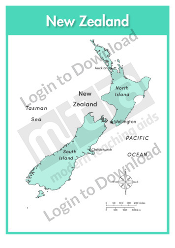
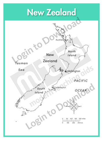
This full colour map of New Zealand with labels is a single full page map complete with compass and scale that can be reproduced for classroom use. It features labelled key cities and surrounding seas and oceans.
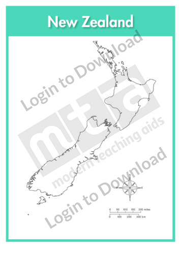
This outline map of New Zealand is a single full page map complete with compass and scale that can be reproduced for classroom use. It is left blank for students to identify and label key cities, geographical landmarks, surrounding seas and oceans.
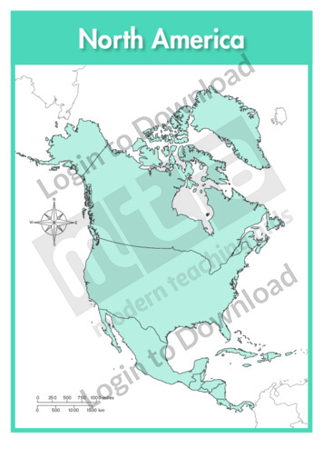
This continent map of North America is a single full page map complete with compass and scale that can be reproduced for classroom use. It is left blank for students to identify and label countries, key cities, bordering countries and surrounding seas and oceans.
This continent outline map of North America with labels is a single full page map complete with compass and scale that can be reproduced for classroom use. It features labelled surrounding seas and oceans.
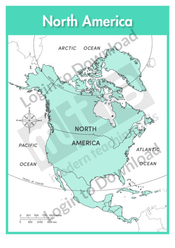
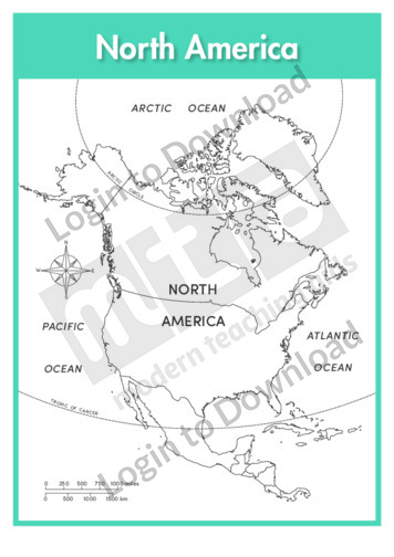
This continent map of North America with labels is a single full page map complete with compass and scale that can be reproduced for classroom use. It features labelled surrounding seas and oceans.
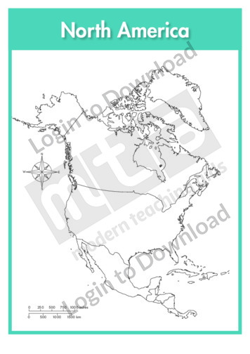
This continent outline map of North America is a single full page map complete with compass and scale that can be reproduced for classroom use. It is left blank for students to identify and label countries, key cities, bordering countries and surrounding seas and oceans.
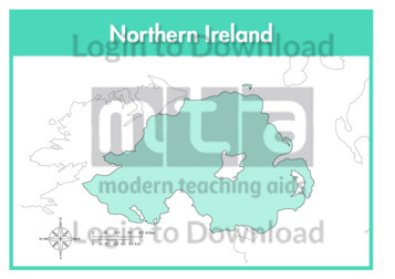
This full colour map of Northern Ireland is a single full page map complete with compass and scale that can be reproduced for classroom use. It is left blank for students to identify and label key cities, geographical landmarks, surrounding seas and bordering countries.
This outline map of Northern Ireland with labels is a single full page map complete with compass and scale that can be reproduced for classroom use. It features labelled key cities and surrounding seas.
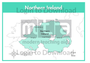
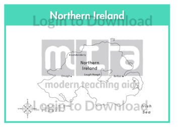
This full colour map of Northern Ireland with labels is a single full page map complete with compass and scale that can be reproduced for classroom use. It features labelled key cities, surrounding seas and indicates bordering countries.
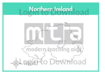
This outline map of Northern Ireland is a single full page map complete with compass and scale that can be reproduced for classroom use. It is left blank for students to identify and label key cities, geographical landmarks and surrounding seas.
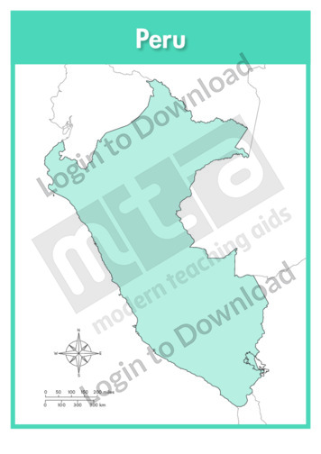
This full colour map of Peru is a single full page map complete with compass and scale that can be reproduced for classroom use. It is left blank for students to identify and label key cities, geographical landmarks, surrounding oceans and bordering countries.
This outline map of Peru with labels is a single full page map complete with compass and scale that can be reproduced for classroom use. It features the labelled capital city, geographical landmarks and surrounding oceans.
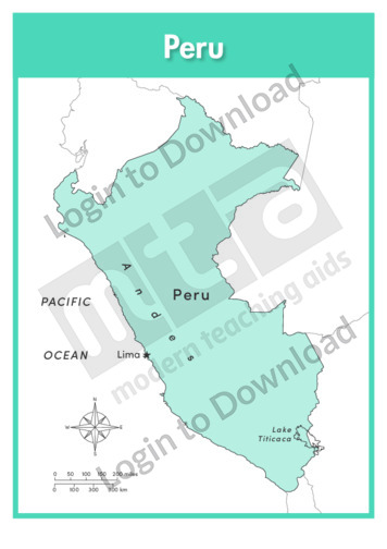
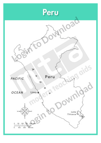
This full colour map of Peru with labels is a single full page map complete with compass and scale that can be reproduced for classroom use. It features the labelled capital city, geographical landmarks, surrounding oceans and indicates bordering countries.
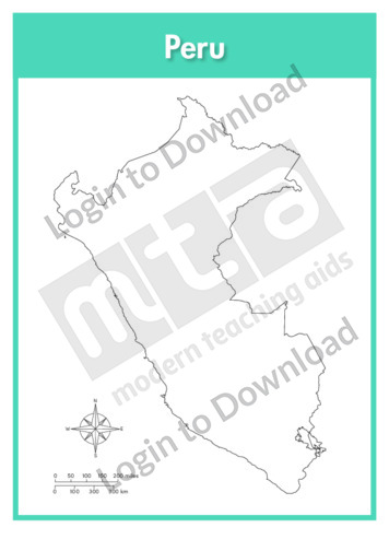
This outline map of Peru is a single full page map complete with compass and scale that can be reproduced for classroom use. It is left blank for students to identify and label key cities, geographical landmarks and surrounding oceans.
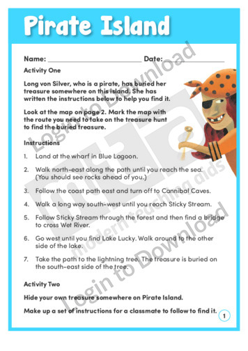
In this learning activity, ‘Pirate Island’, students follow a set of directions and mark a map with the route to Long von Silver’s buried treasure. Students then hide their own treasure and make up instructions for their classmates to follow. An answer sheet is provided and includes teaching notes with suggestions for supporting learning and …More
It�s that easy!