
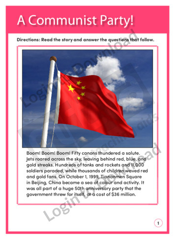
This reading comprehension activity ‘A Communist Party!’, asks students to answer comprehension questions on a text about the Communist party in China.
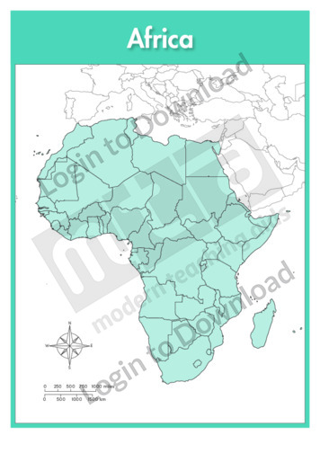
This full colour map of Africa political is a single full page map complete with compass and scale that can be reproduced for classroom use. It is left blank for students to identify and label the countries, cities, geographical landmarks and surrounding oceans.
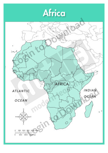
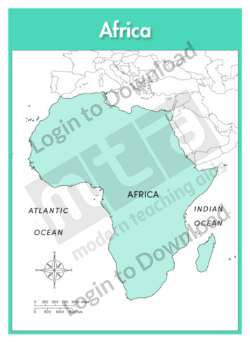
This full colour map of Africa political with labels is a single full page map complete with compass and scale that can be reproduced for classroom use. It features country borders and surrounding oceans.

This full colour continent map of Africa is a single full page map complete with compass and scale that can be reproduced for classroom use. It is left blank for students to identify and label countries, key cities, bordering countries and surrounding seas and oceans.
This continent outline map of Africa with labels is a single full page map complete with compass and scale that can be reproduced for classroom use. It features labelled surrounding seas and oceans.
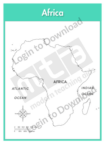
This full colour continent map of Africa with labels is a single full page map complete with compass and scale that can be reproduced for classroom use. It features labelled surrounding seas and oceans.
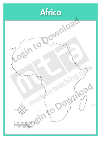
This continent outline map of Africa is a single full page map complete with compass and scale that can be reproduced for classroom use. It is left blank for students to identify and label countries, key cities, bordering countries and surrounding seas and oceans.
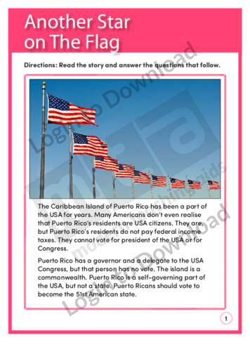
This reading comprehension activity, ‘Another Star on the Flag’, asks students to answer comprehension questions on a text about Puerto Rico and the United States.
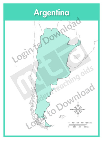
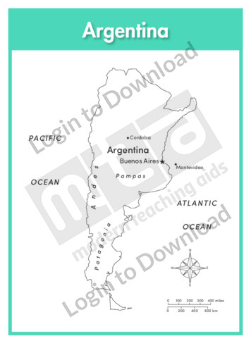
This full colour map of Argentina is a single full page map complete with compass and scale that can be reproduced for classroom use. It is left blank for students to identify and label key cities, geographical landmarks, geographical landmarks, surrounding oceans and bordering countries.
This outline map of Argentina with labels is a single full page map complete with compass and scale that can be reproduced for classroom use. It features labelled key cities, geographical landmarks and surrounding oceans.
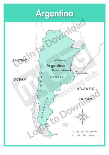
This full colour map of Argentina with labels is a single full page map complete with compass and scale that can be reproduced for classroom use. It features labelled key cities, geographical landmarks, surrounding oceans and indicates bordering countries.
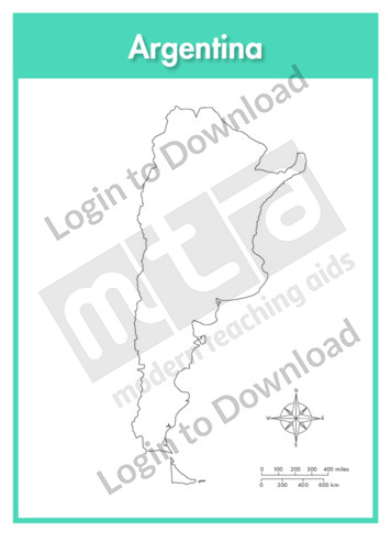
This outline map of Argentina is a single full page map complete with compass and scale that can be reproduced for classroom use. It is left blank for students to identify and label key cities, geographical landmarks and surrounding oceans.
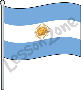
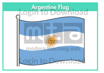
This illustration, “Argentina, flag” is available in PNG format at 300 DPI resolution with a transparent background for classroom use. This illustration is also available in black and white. Lesson Zone has over 4, 000 pieces of clip art, searchable by learning area and theme. The clip art is fast and easy to download, and …More
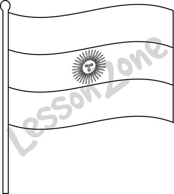
This black and white outline illustration, “Argentina, flag B&W” is available in PNG format at 300 DPI resolution with a transparent background for classroom use. This illustration is also available in colour. Lesson Zone has over 4, 000 pieces of clip art, searchable by learning area and theme. The clip art is fast and easy …More
This flag worksheet features the Argentine flag in full colour followed by a black and white version for students to colour in the appropriate colours.
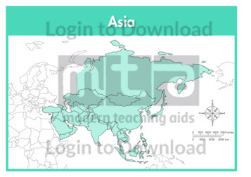
This continent map of Asia is a single full page map complete with compass and scale that can be reproduced for classroom use. It is left blank for students to identify and label countries, key cities, bordering countries and surrounding seas and oceans.
This continent outline map of Asia with labels is a single full page map complete with compass and scale that can be reproduced for classroom use. It features labelled surrounding seas and oceans.
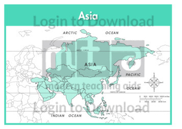
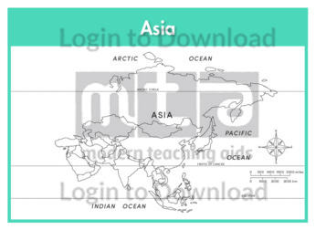
This continent map of Asia with labels is a single full page map complete with compass and scale that can be reproduced for classroom use. It features labelled surrounding seas and oceans.
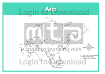
This continent outline map of Asia is a single full page map complete with compass and scale that can be reproduced for classroom use. It is left blank for students to identify and label countries, key cities, bordering countries and surrounding seas and oceans.
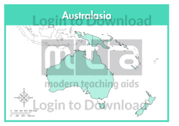
This continent full colour map of Australasia is a single full page map complete with compass and scale that can be reproduced for classroom use. It is left blank for students to identify and label countries, key cities, bordering countries and surrounding seas and oceans.
This continent outline map of Australasia with labels is a single full page map complete with compass and scale that can be reproduced for classroom use. It features labelled surrounding seas and oceans.
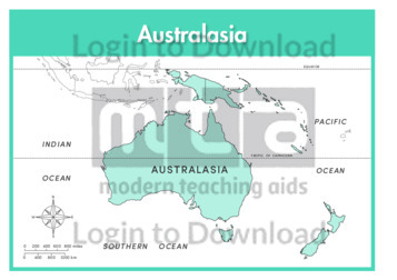
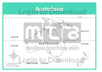
This continent full colour map of Australasia with labels is a single full page map complete with compass and scale that can be reproduced for classroom use. It features labelled surrounding seas and oceans.
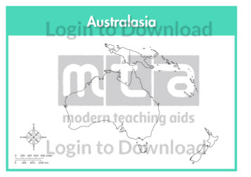
This continent outline map of Australasia is a single full page map complete with compass and scale that can be reproduced for classroom use. It is left blank for students to identify and label countries, key cities, bordering countries and surrounding seas and oceans.
This full colour map of Australia is a single full page map complete with compass and scale that can be reproduced for classroom use. It is left blank for students to identify and label states, key cities, geographical landmarks, surrounding oceans.
This outline map of Australia with labels is a single full page map complete with compass and scale that can be reproduced for classroom use. It features labelled key cities and surrounding oceans.
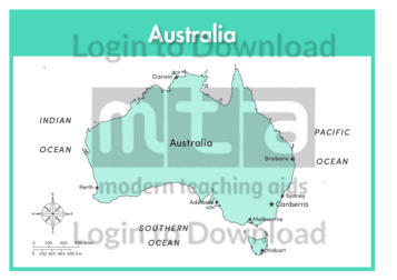
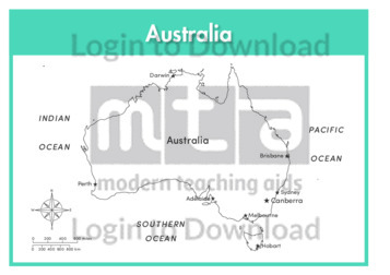
This full colour map of Australia with labels is a single full page map complete with compass and scale that can be reproduced for classroom use. It features labelled key cities and surrounding oceans.
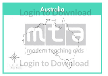
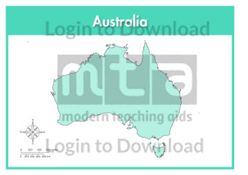
This outline map of Australia is a single full page map complete with compass and scale that can be reproduced for classroom use. It is left blank for students to identify and label states, key cities, geographical landmarks and surrounding oceans.
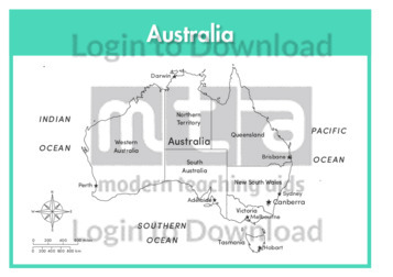
This outline map of Australia with state labels is a single full page map complete with compass and scale that can be reproduced for classroom use. It features labelled states, key cities and surrounding oceans.
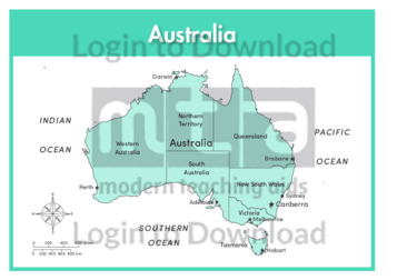
This full colour map of Australia with state labels is a single full page map complete with compass and scale that can be reproduced for classroom use. It features labelled states, key cities and surrounding oceans.
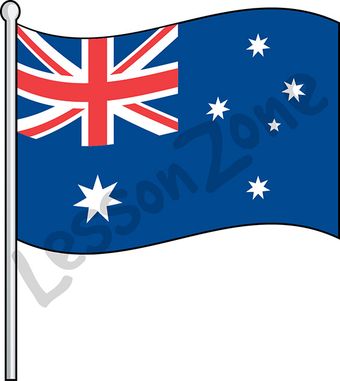
This illustration, “Australia, flag” is available in PNG format at 300 DPI resolution with a transparent background for classroom use. This illustration is also available in black and white. Lesson Zone has over 4, 000 pieces of clip art, searchable by learning area and theme. The clip art is fast and easy to download, and …More
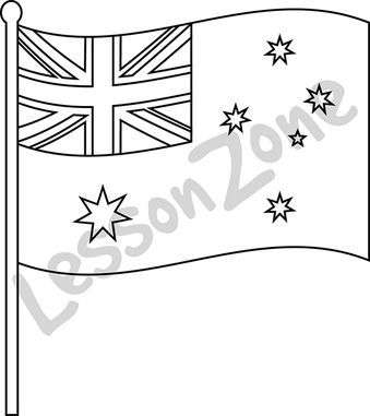
This black and white outline illustration, “Australia, flag B&W” is available in PNG format at 300 DPI resolution with a transparent background for classroom use. This illustration is also available in colour. Lesson Zone has over 4, 000 pieces of clip art, searchable by learning area and theme. The clip art is fast and easy …More
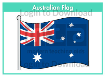
This flag worksheet features the Australian flag in full colour followed by a black and white version for students to colour in the appropriate colours.
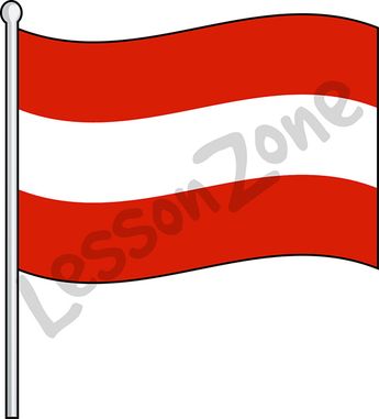
This illustration, “Austria, flag” is available in PNG format at 300 DPI resolution with a transparent background for classroom use. This illustration is also available in black and white. Lesson Zone has over 4, 000 pieces of clip art, searchable by learning area and theme. The clip art is fast and easy to download, and …More
This black and white outline illustration, “Austria, flag B&W” is available in PNG format at 300 DPI resolution with a transparent background for classroom use. This illustration is also available in colour. Lesson Zone has over 4, 000 pieces of clip art, searchable by learning area and theme. The clip art is fast and easy …More
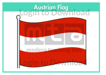
This flag worksheet features the Austrian flag in full colour followed by a black and white version for students to colour in the appropriate colours.
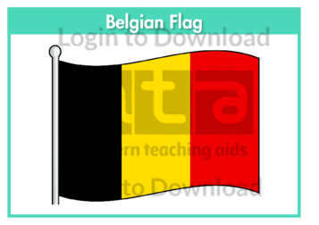
This flag worksheet features the Belgian flag in full colour followed by a black and white version for students to colour in the appropriate colours.
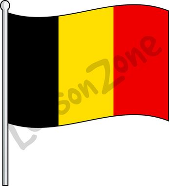
This illustration, “Belgium, flag” is available in PNG format at 300 DPI resolution with a transparent background for classroom use. This illustration is also available in black and white. Lesson Zone has over 4, 000 pieces of clip art, searchable by learning area and theme. The clip art is fast and easy to download, and …More
This black and white outline illustration, “Belgium, flag B&W” is available in PNG format at 300 DPI resolution with a transparent background for classroom use. This illustration is also available in colour. Lesson Zone has over 4, 000 pieces of clip art, searchable by learning area and theme. The clip art is fast and easy …More
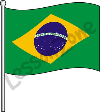
This illustration, “Brazil, flag” is available in PNG format at 300 DPI resolution with a transparent background for classroom use. This illustration is also available in black and white. Lesson Zone has over 4, 000 pieces of clip art, searchable by learning area and theme. The clip art is fast and easy to download, and …More
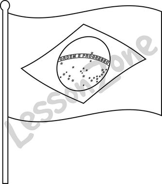
This black and white outline illustration, “Brazil, flag B&W” is available in PNG format at 300 DPI resolution with a transparent background for classroom use. This illustration is also available in colour. Lesson Zone has over 4, 000 pieces of clip art, searchable by learning area and theme. The clip art is fast and easy …More
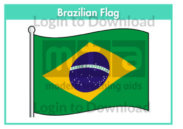
This flag worksheet features the Brazilian flag in full colour followed by a black and white version for students to colour in the appropriate colours.
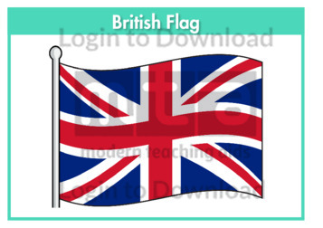
This flag worksheet features the British flag in full colour followed by a black and white version for students to colour in the appropriate colours.
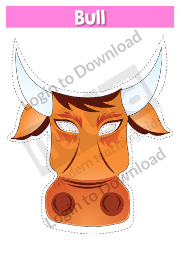
This role-play mask ‘Bull’ is a resource that can be used in a variety of classroom activities. It is a hands-on tool that provides a stimulus to prompt vocabulary and concept development. Use it during class discussions to fuel engagement, or have students use their imaginations to incorporate the mask into other speaking activities. It …More
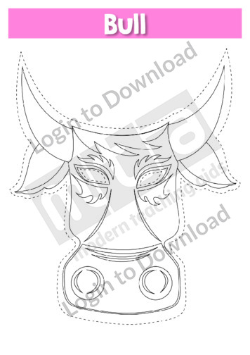
This role-play mask ‘Bull B&W’ is a resource that can be used in a variety of classroom activities. It is a hands-on tool that provides a stimulus to prompt vocabulary and concept development. Use it during class discussions to fuel engagement, or have students use their imaginations to incorporate the mask into other speaking activities. …More
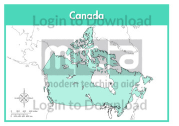
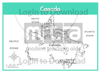
This full colour map of Canada is a single full page map complete with compass and scale that can be reproduced for classroom use. It is left blank for students to identify and label provinces, key cities, geographical landmarks, surrounding oceans and bordering countries.
This outline map of Canada with labels is a single full page map complete with compass and scale that can be reproduced for classroom use. It features labelled key cities and surrounding oceans.
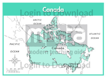
This full colour map of Canada with labels is a single full page map complete with compass and scale that can be reproduced for classroom use. It features labelled key cities, surrounding oceans and indicates bordering countries.
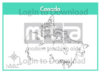
This outline map of Canada is a single full page map complete with compass and scale that can be reproduced for classroom use. It is left blank for students to identify and label provinces, key cities, geographical landmarks and surrounding oceans.
This outline map of Canada with provinces is a single full page map complete with compass and scale that can be reproduced for classroom use. It features labelled provinces, key cities and surrounding oceans.
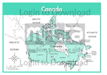
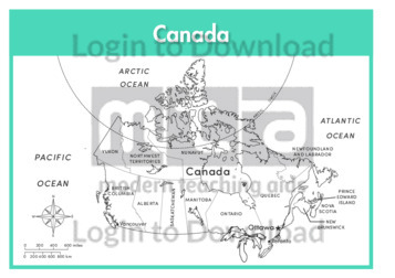
This full colour map of Canada with provinces is a single full page map complete with compass and scale that can be reproduced for classroom use. It features labelled provinces, key cities, surrounding oceans and indicates bordering countries.
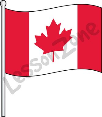
This illustration, “Canada, flag” is available in PNG format at 300 DPI resolution with a transparent background for classroom use. This illustration is also available in black and white. Lesson Zone has over 4, 000 pieces of clip art, searchable by learning area and theme. The clip art is fast and easy to download, and …More
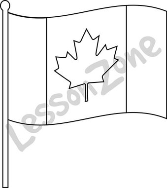
This black and white outline illustration, “Canada, flag B&W” is available in PNG format at 300 DPI resolution with a transparent background for classroom use. This illustration is also available in colour. Lesson Zone has over 4, 000 pieces of clip art, searchable by learning area and theme. The clip art is fast and easy …More
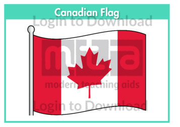
This flag worksheet features the Canadian flag in full colour followed by a black and white version for students to colour in the appropriate colours.
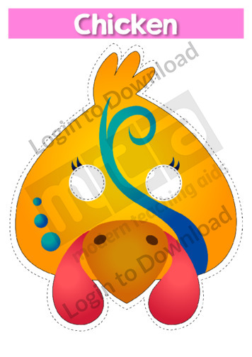
This role-play mask ‘Chicken’ is a resource that can be used in a variety of classroom activities. It is a hands-on tool that provides a stimulus to prompt vocabulary and concept development. Use it during class discussions to fuel engagement, or have students use their imaginations to incorporate the mask into other speaking activities. It …More
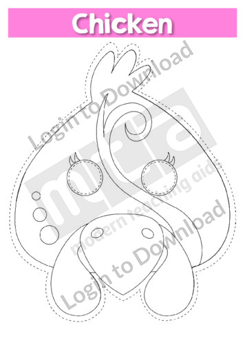
This role-play mask ‘Chicken B&W’ is a resource that can be used in a variety of classroom activities. It is a hands-on tool that provides a stimulus to prompt vocabulary and concept development. Use it during class discussions to fuel engagement, or have students use their imaginations to incorporate the mask into other speaking activities. …More
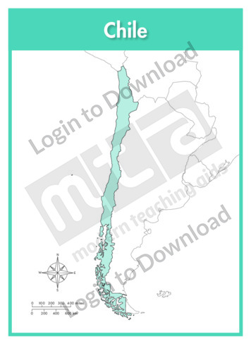
This full colour map of Chile is a single full page map complete with compass and scale that can be reproduced for classroom use. It is left blank for students to identify and label key cities, geographical landmarks, surrounding oceans and bordering countries.
This outline map of Chile with labels is a single full page map complete with compass and scale that can be reproduced for classroom use. It features the labelled capital city and surrounding oceans.
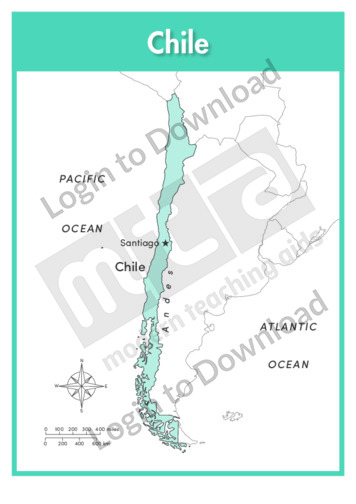
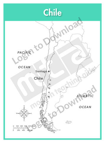
This full colour map of Chile with labels is a single full page map complete with compass and scale that can be reproduced for classroom use. It features the labelled capital city, geographical landmarks, surrounding oceans and indicates bordering countries.
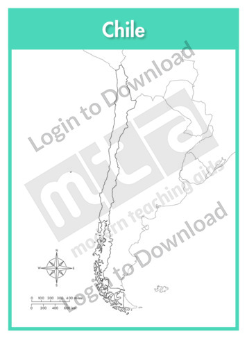
This outline map of Chile is a single full page map complete with compass and scale that can be reproduced for classroom use. It is left blank for students to identify and label key cities, geographical landmarks and surrounding oceans.
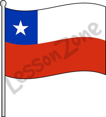
This illustration, “Chile, flag” is available in PNG format at 300 DPI resolution with a transparent background for classroom use. This illustration is also available in black and white. Lesson Zone has over 4, 000 pieces of clip art, searchable by learning area and theme. The clip art is fast and easy to download, and …More
It�s that easy!