
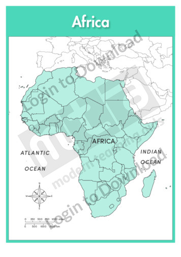
This full colour map of Africa political with labels is a single full page map complete with compass and scale that can be reproduced for classroom use. It features country borders and surrounding oceans.

This full colour continent map of Africa is a single full page map complete with compass and scale that can be reproduced for classroom use. It is left blank for students to identify and label countries, key cities, bordering countries and surrounding seas and oceans.
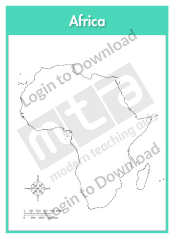
This continent outline map of Africa with labels is a single full page map complete with compass and scale that can be reproduced for classroom use. It features labelled surrounding seas and oceans.
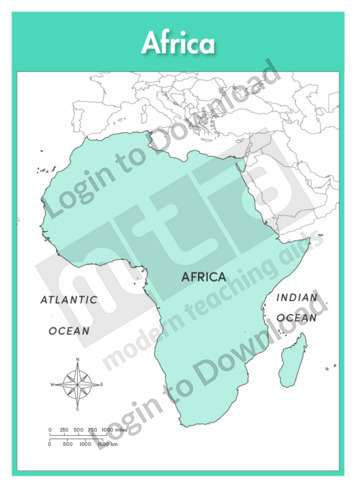
This full colour continent map of Africa with labels is a single full page map complete with compass and scale that can be reproduced for classroom use. It features labelled surrounding seas and oceans.
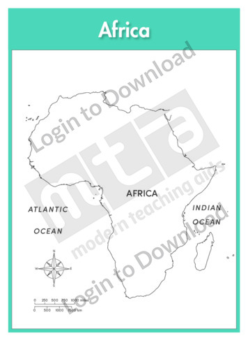
This continent outline map of Africa is a single full page map complete with compass and scale that can be reproduced for classroom use. It is left blank for students to identify and label countries, key cities, bordering countries and surrounding seas and oceans.
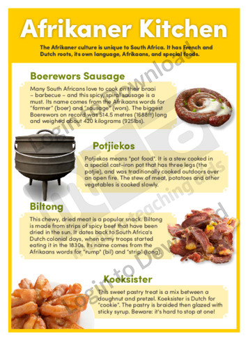
This history article ‘Afrikaner Kitchen’ features important factual background information about the objects and symbols associated with the cuisine of this South African ethnic group. It identifies the Boerewors sausage, potjiekos, biltong and koeksister as icons of Afrikaner food, which are still eaten in South Africa today. It is aimed at broadening students’ historical and …More
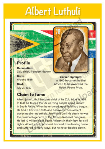
This history poster ‘Albert Luthuli’ features important factual background information about the man who courageously led the African National Congress in its fight against apartheid. This is a great resource for broadening students’ knowledge of significant figures from South African history and could be used as a prompt for further discussion or study of racism …More
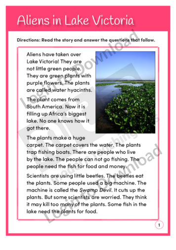
This reading comprehension activity, ‘Aliens in Lake Victoria’, asks students to answer comprehension questions about plants that are growing in Lake Victoria in Africa.
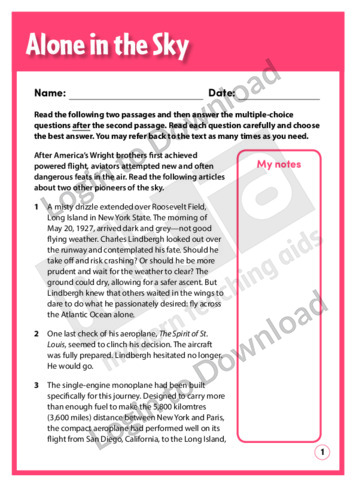
The paired texts, ‘Alone in the Sky’ and ‘Twice’ describe the pioneering flights of Charles Lindbergh and Amelia Earhart as they flew between North America and Europe. They provide opportunities for students to practise vocabulary and comprehension skills. Answer sheet provided with file download.
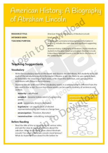
This Readers Theatre activity, ‘Biography: Abraham Lincoln’ encourages students to summarise and paraphrase information in texts. It also builds reading fluency. This activity includes a script for 5 readers.
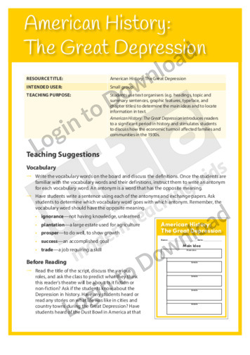
This Readers Theatre activity, ‘The Great Depression’ encourages students to use text organisers to determine the main ideas and to locate information in texts. It also builds reading fluency. This activity includes a script for 5 readers.
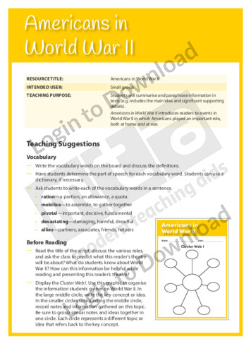
This Readers Theatre activity, ‘World War 2’ encourages students to summarise and paraphrase information in texts. It also builds reading fluency. This activity includes a script for 4 readers.
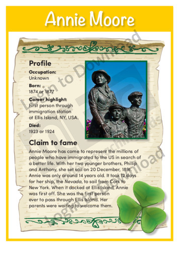
This history poster ‘Annie Moore’ features important factual background information about the first immigrant to pass through Ellis Island in NY, USA. Annie Moore came to represent emigrants from around the world, not least of which the Irish. This is a great resource for broadening students’ knowledge of significant figures from Irish history and could …More
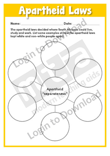
This worksheet, ‘Apartheid Laws’ is a helpful resource that asks students to research some laws of the apartheid rule. The resource provides a graphical organiser in which students can list some examples of how the apartheid laws kept white and non-white people apart in order to better understand and create meaningful discussions about apartheid.
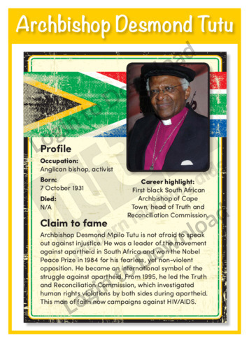
This history poster ‘Archbishop Desmond Tutu’ features important factual background information about this man of faith, his struggle against apartheid and his role in national reconciliation. This is a great resource for broadening students’ knowledge of significant figures from South African history and could be used as a prompt for further discussion or study of …More
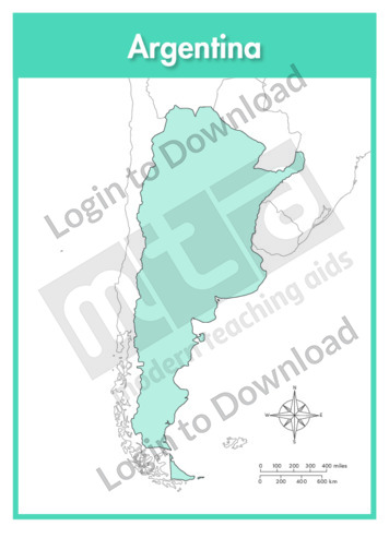
This full colour map of Argentina is a single full page map complete with compass and scale that can be reproduced for classroom use. It is left blank for students to identify and label key cities, geographical landmarks, geographical landmarks, surrounding oceans and bordering countries.
This outline map of Argentina with labels is a single full page map complete with compass and scale that can be reproduced for classroom use. It features labelled key cities, geographical landmarks and surrounding oceans.
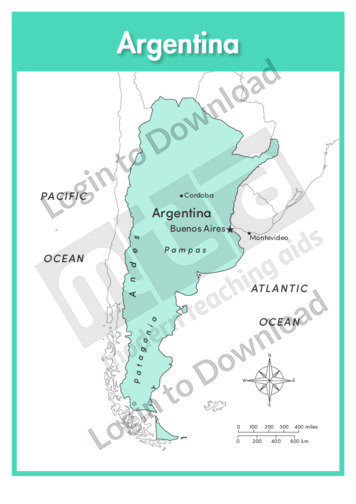
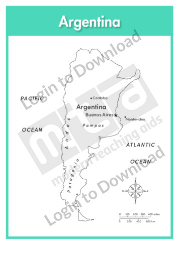
This full colour map of Argentina with labels is a single full page map complete with compass and scale that can be reproduced for classroom use. It features labelled key cities, geographical landmarks, surrounding oceans and indicates bordering countries.
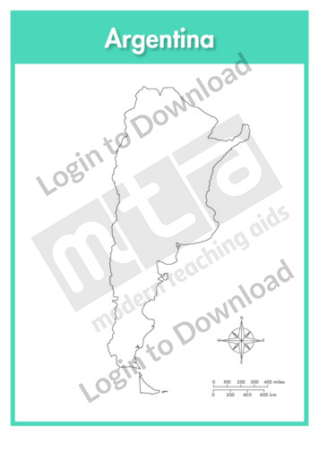
This outline map of Argentina is a single full page map complete with compass and scale that can be reproduced for classroom use. It is left blank for students to identify and label key cities, geographical landmarks and surrounding oceans.
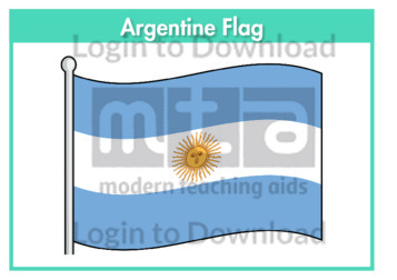
This flag worksheet features the Argentine flag in full colour followed by a black and white version for students to colour in the appropriate colours.
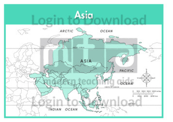
This continent map of Asia is a single full page map complete with compass and scale that can be reproduced for classroom use. It is left blank for students to identify and label countries, key cities, bordering countries and surrounding seas and oceans.
This continent outline map of Asia with labels is a single full page map complete with compass and scale that can be reproduced for classroom use. It features labelled surrounding seas and oceans.
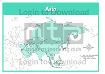
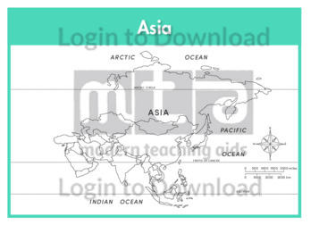
This continent map of Asia with labels is a single full page map complete with compass and scale that can be reproduced for classroom use. It features labelled surrounding seas and oceans.
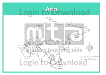
This continent outline map of Asia is a single full page map complete with compass and scale that can be reproduced for classroom use. It is left blank for students to identify and label countries, key cities, bordering countries and surrounding seas and oceans.
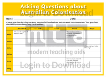
This worksheet, ‘Asking Questions about Australian Colonisation’ prompts students to create questions using one word from the left column and one word from the top row that can help in discussing and researching the arrival of the First Fleet. This great resource assists students in creating progressively more complex, higher-order questions to prompt critical thinking. …More
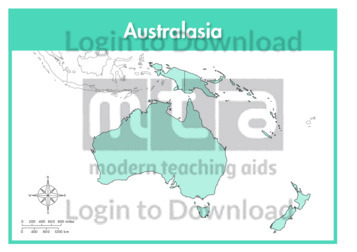
This continent full colour map of Australasia is a single full page map complete with compass and scale that can be reproduced for classroom use. It is left blank for students to identify and label countries, key cities, bordering countries and surrounding seas and oceans.
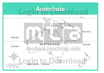
This continent outline map of Australasia with labels is a single full page map complete with compass and scale that can be reproduced for classroom use. It features labelled surrounding seas and oceans.
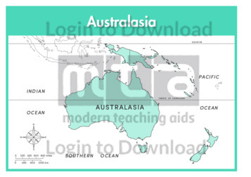
This continent full colour map of Australasia with labels is a single full page map complete with compass and scale that can be reproduced for classroom use. It features labelled surrounding seas and oceans.
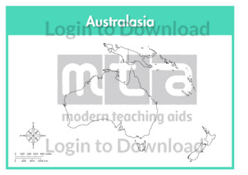
This continent outline map of Australasia is a single full page map complete with compass and scale that can be reproduced for classroom use. It is left blank for students to identify and label countries, key cities, bordering countries and surrounding seas and oceans.
This full colour map of Australia is a single full page map complete with compass and scale that can be reproduced for classroom use. It is left blank for students to identify and label states, key cities, geographical landmarks, surrounding oceans.
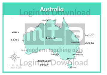
This outline map of Australia with labels is a single full page map complete with compass and scale that can be reproduced for classroom use. It features labelled key cities and surrounding oceans.
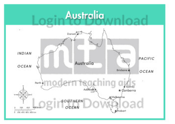
This full colour map of Australia with labels is a single full page map complete with compass and scale that can be reproduced for classroom use. It features labelled key cities and surrounding oceans.
This outline map of Australia is a single full page map complete with compass and scale that can be reproduced for classroom use. It is left blank for students to identify and label states, key cities, geographical landmarks and surrounding oceans.
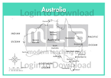
This outline map of Australia with state labels is a single full page map complete with compass and scale that can be reproduced for classroom use. It features labelled states, key cities and surrounding oceans.
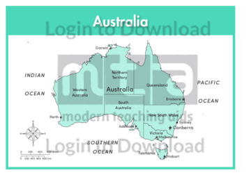
This full colour map of Australia with state labels is a single full page map complete with compass and scale that can be reproduced for classroom use. It features labelled states, key cities and surrounding oceans.
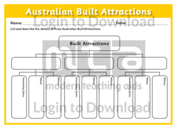
This worksheet, ‘Australian Built Attractions’ is an upside-down tree diagram used to organise details that stem from the umbrella concept of Australian built attractions. Students can use this graphical scaffold to explore three Australian built attractions and expand on where and when they were built and any interesting facts about them. It is a fun …More
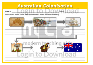
This worksheet, ‘Australian Colonisation’ asks students to use a storyboard to visually represent the relationship between sequential events. This resource is particularly useful in prompting exploration of Australian history and requires students to explain the sequence of events using pictures clues provided. Alternatively the students may be given the narration of events without pictures and …More
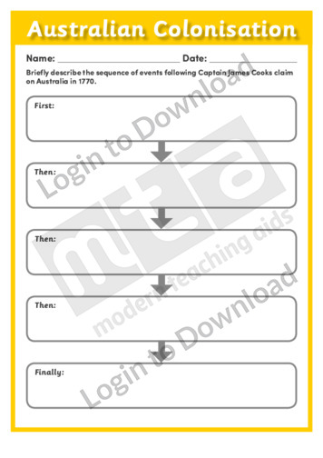
This worksheet, ‘Australian Colonisation’ provides students with a scaffold to logically sequence the major events following Captain James Cook’s claim on Australia in 1770. This resource logically segments students’ writing using prompts such as, first, then and finally to demonstrate the importance of chronologically sequencing historical events. The simple structure and can be used in …More
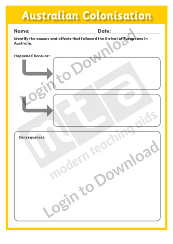
This worksheet, ‘Australian Colonisation’ assists students to graphically organise sequence of the causes and effects of the arrival of Europeans in Australia. It can be used as a comprehension activity or as a prompt for discussion. This is a great resource to encourage the use of higher-order and critical thinking skills.
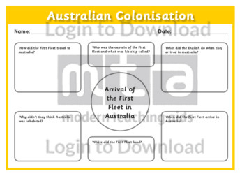
This worksheet, ‘Australian Colonisation’ provides a structured diagram that helps students identify the who, what, when, where, why and how of the arrival of Europeans in Australia. It is a great visual graphic that can be used as a comprehension activity and to generate meaningful class discussion.
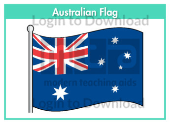
This flag worksheet features the Australian flag in full colour followed by a black and white version for students to colour in the appropriate colours.
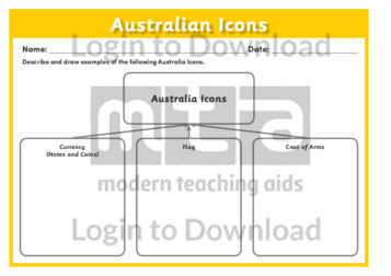
This worksheet, ‘Australian Icons’ assists students to identify the relationship between the umbrella concept of Australian icons and Australia’s currency, flag and coat of arms. For example, students can use this graphical scaffold to provide evidence of their learning following the completion of an activity or topic. Alternatively, it can be used effectively in pairs …More
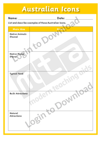
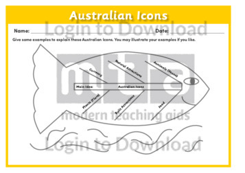
This worksheet, ‘Australian Icons’ assists students to explore different Australian icons in detail. It allows students to easily break-down the broad concept of various Australian icons from the main idea into more specific ideas and can be used to prompt further research or discussion.
This worksheet, ‘Australian Icons’ provides a blank web that students can use to organise and brainstorm types of Australian icons. It is a simple resource that can be used across all ability levels and either in groups, as individuals or during whole class discussions. It can also be used to consolidate learning or demonstrate understanding.
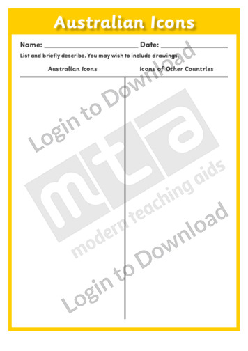
This worksheet, ‘Australian Icons’ provides students with a simple format to help make comparisons between Australian icons and icons associated with other countries. This is a very simple resource that will encourage the use of higher-order, critical thinking skills as it requires students to think beyond their own frames of reference. It can also be …More
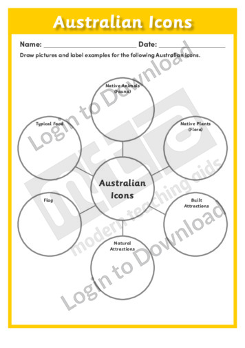
This worksheet, ‘Australian Icons’ combines brainstorming and mind mapping skills to build an understanding of the relationship between six different Australian icons. It helps students to visualise all possible ideas instead of simply focusing on the obvious and can be used as an fun introductory activity or to evaluate understanding following research.

The classic song ‘Australian National Anthem’ is presented with illustrations ready for projection or printing. It provides a simple and engaging introduction to following rhythm and rhyme whilst simultaneously encouraging group cooperation and interaction. Accompanying sheet music is available for each item in this collection of classic songs and nursery rhymes.
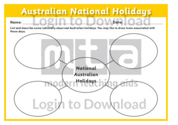
This worksheet, ‘Australian National Holidays’ provides a blank web that students can use to brainstorm and explore various Australian national holidays. It can be used effectively with a whole class, individually, or in groups to prompt discussion before further research or as a follow-up activity.
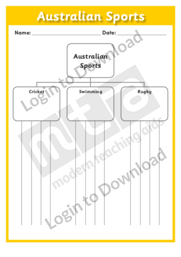
This worksheet, ‘Australian Sports’ is an upside-down tree diagram used to organise the flow of ideas into a top down format. Students can use this graphical scaffold to break down types of sports that are considered typically Australian. The hierarchy chart is a great resource to allow students to expand upon ideas using details. It …More
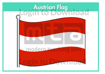
This flag worksheet features the Austrian flag in full colour followed by a black and white version for students to colour in the appropriate colours.
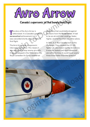
This history article, ‘Avro Arrow’, features important factual background information about Canada’s most famous aeronautical achievement. It describes the development and eventual cancellation of the avro arrow project and what it meant for Canada. It is aimed at broadening students’ historical and cultural awareness and could be used as a prompt for further discussion or …More
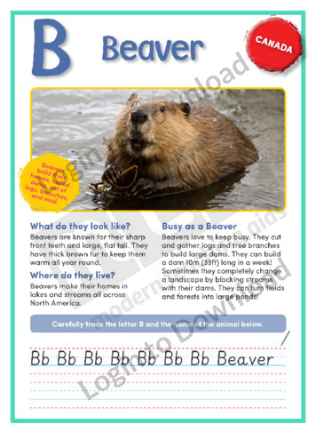
This geography article, ‘Beaver’, features factual information about this iconic Canadian animal. It is aimed at broadening students’ geographical and historical awareness in an engaging manner.
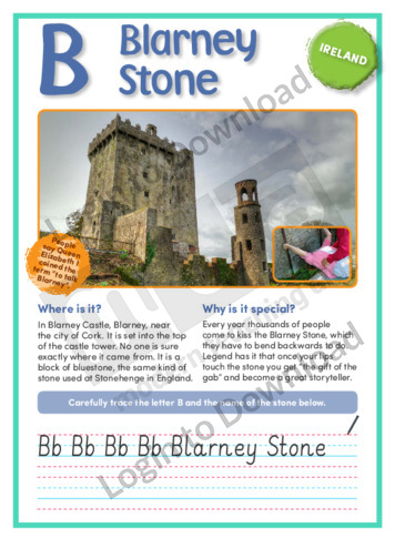
This short nonfiction text, ‘B: Blarney Stone’ features important factual background information about the famous stone in Blarney Castle that gives you legendary powers if you kiss it. It is aimed at broadening students’ awareness of the symbols and icons associated with Irish culture and also features an activity for students to practise their handwriting.
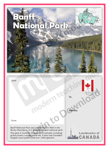
This postcard, ‘Banff National Park’, features important factual background information about Canada’s oldest national park. The postcard template encourages students to research the location in order to write creatively about it as though recounting a visit. It is aimed at broadening students’ awareness of the cultural and historical landmarks of Canada and can be used …More
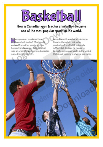
This history article, ‘Basketball’, features important factual background information about the invention of basketball. It explains how Canadian schoolteacher James Naismith came up with the idea for the game as a way to occupy his unruly students. It is aimed at broadening students’ historical and cultural awareness and could be used as a prompt for …More
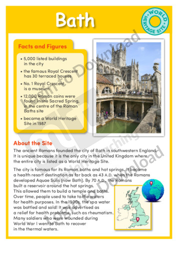
This history article, ‘Bath’ features the World Heritage Site that dates back to Roman times. It provides factual information about the city of Bath, and is aimed at broadening students’ cultural and historical awareness.
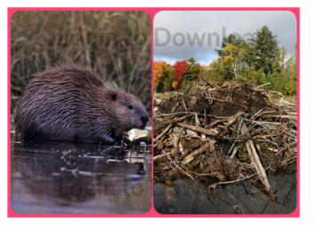
This photo activity card, ‘Beaver’, provides integrated thematic vocabulary and oral language development activities on the topic of beavers. It is aimed at broadening students’ awareness of this iconic Canadian animal and its habitat and can be used as a prompt for further discussion or study of animals in Canada.
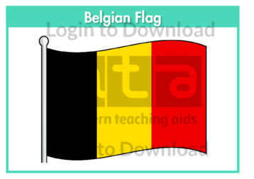
This flag worksheet features the Belgian flag in full colour followed by a black and white version for students to colour in the appropriate colours.
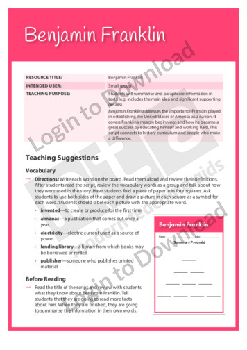
This Readers Theatre activity, ‘Benjamin Franklin’ encourages students to summarise and paraphrase information in texts. It also builds reading fluency. This activity includes a script for 6 readers.
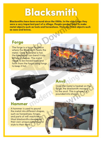
This history article, ‘Blacksmith’, features important factual background information about some of the objects that were used by a blacksmith in Canada in the 19th century. It describes items such as a forge, anvil, and hammer, and explains the role of the blacksmith in the community. It is aimed at broadening students’ historical and cultural …More
It�s that easy!